")
")
Historical Background and Importance
|
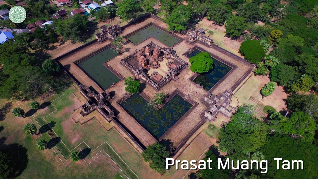
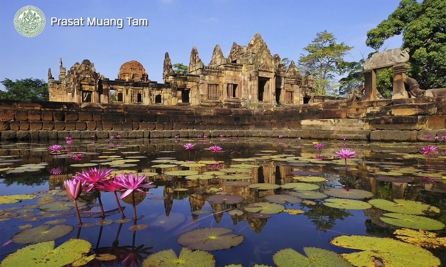
Prasat Muang Tam is located in Khok Maung village, Tambon Chorakhe Mak, Amphoe Prakhon Chai, Buriram Province and far from Prasat Phanom Rung to the southeast about 8 kilometers. The Prasat and village are located on a quite round mound that higher than the hillside area like a field about 2 meters. At the current location of Prasat, there are Wat Prasat Burapharam in the east side, a large pond or Baray with 510 meters wide, 1,090 meters length called Ta Le Muang Tam in the north side and surrounded with dwelling in the south and the west. The important water sources of Kok Muang village, such as Ta Le Muang Tam and stream as Lam Huai Poon, a branch of Huai Pra Tia in the north side, and Huai Nam Khun in the east side which both are the water sources for consuming. The Fine Arts Department has announced the registration of the historical site in the Government Gazette, 52nd volume, 75th part, on 8th March 2478 and specified an area of 538 Rai, 2 Ngaan, 1 Tarang Wa (0.861604 square kilometers) (include Ba Ray Muang Tam) to be the historical site in the Government Gazette, 115th volume, 83rd special episode, on 21st September 2541. |
|
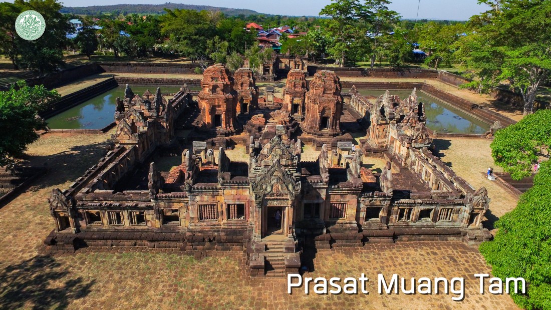
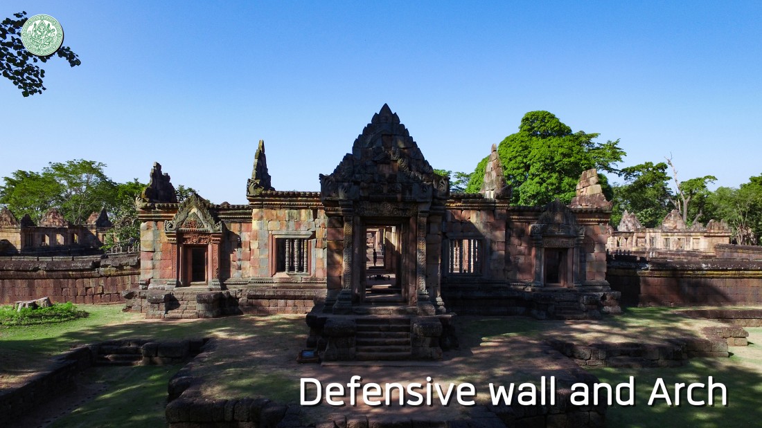
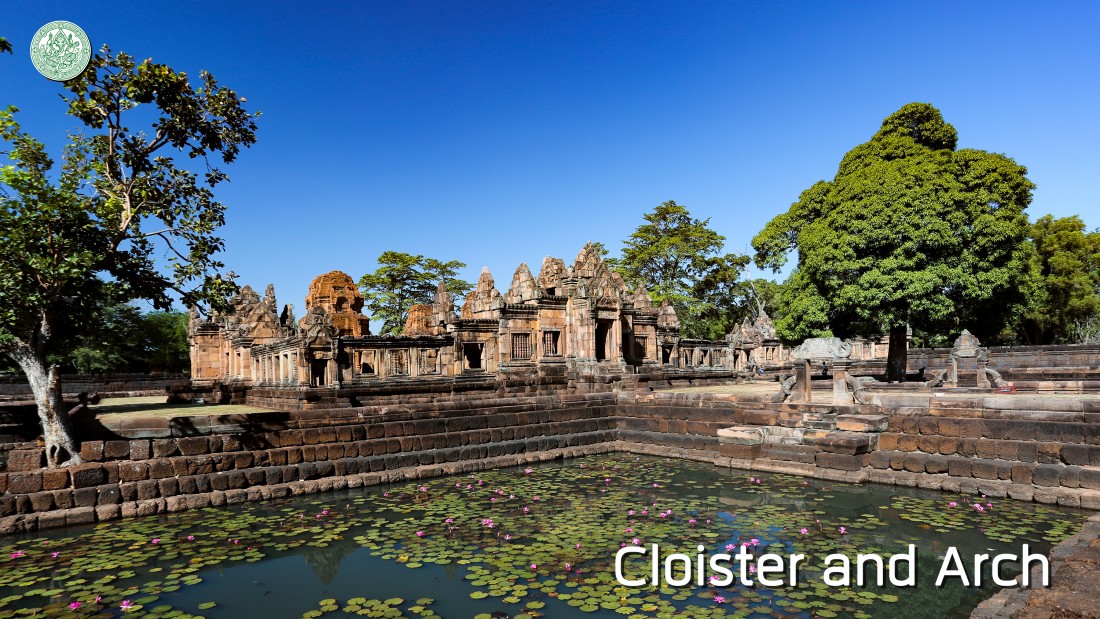
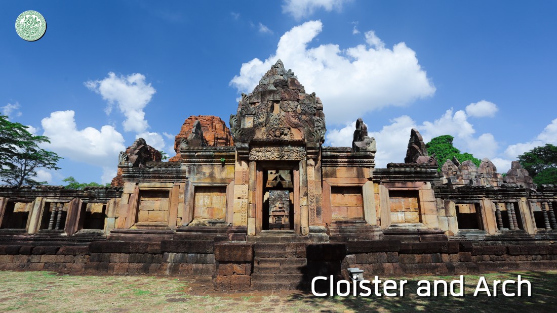
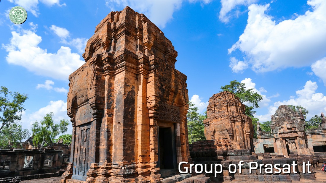
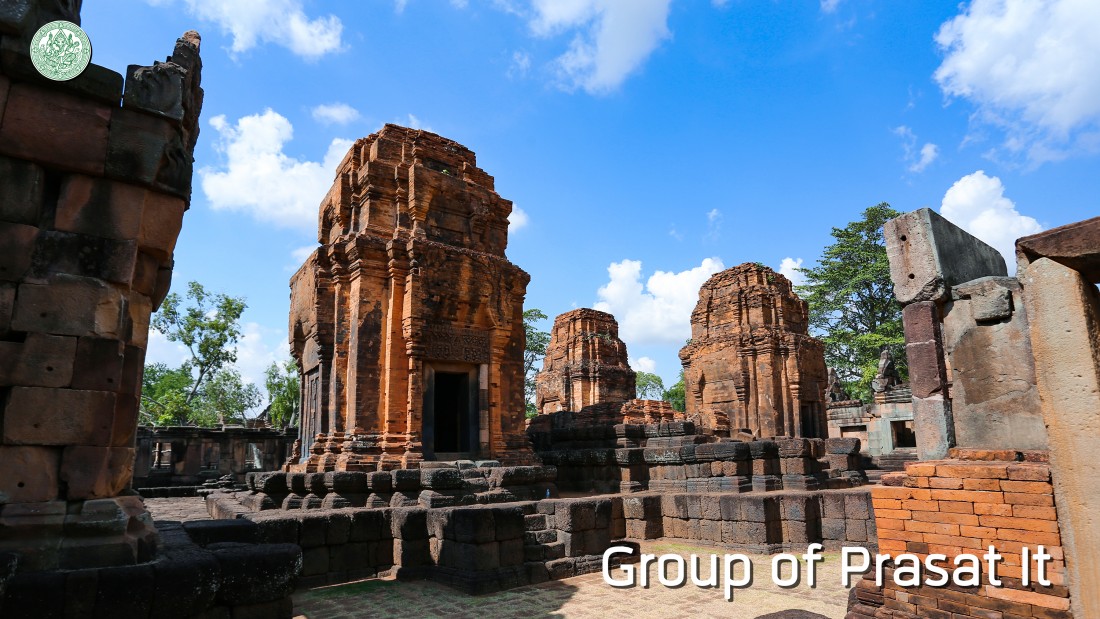
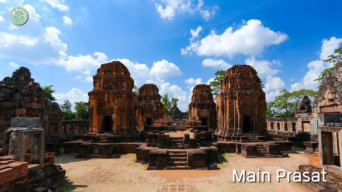
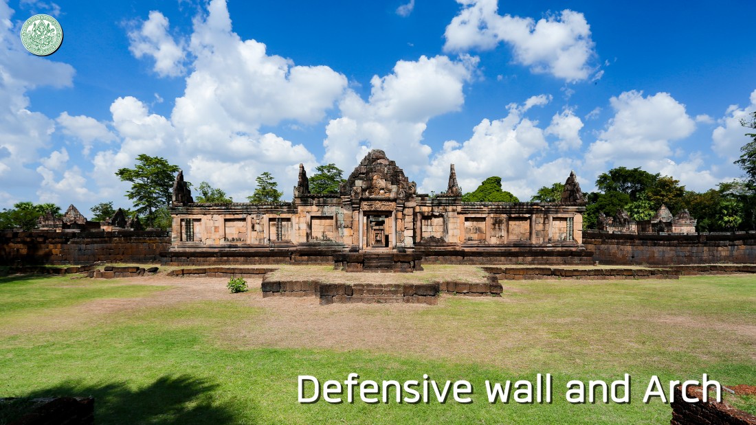
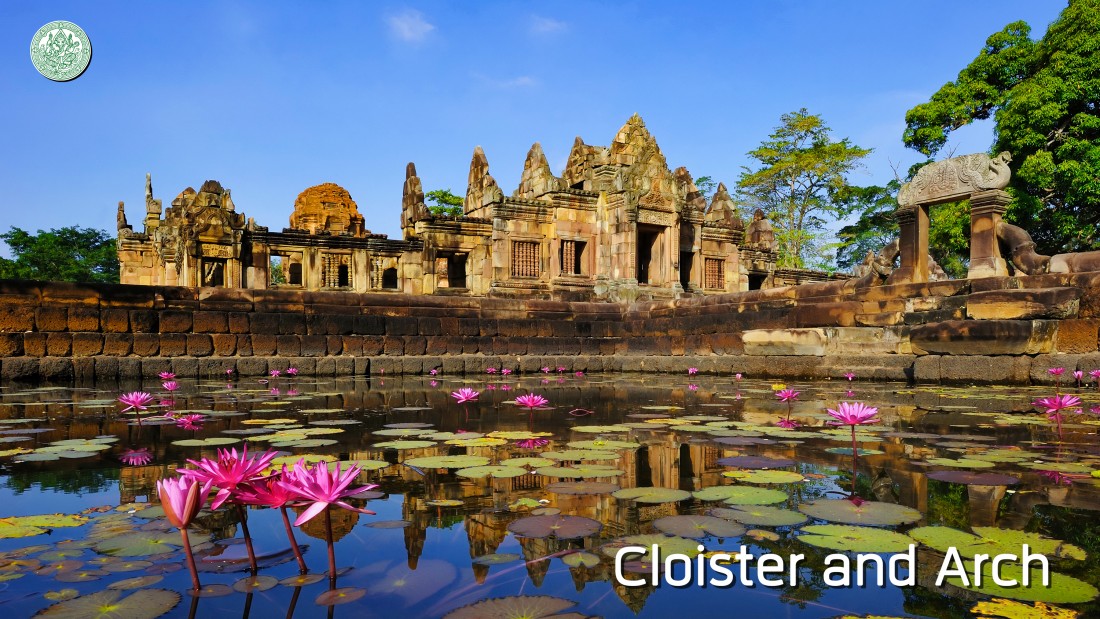
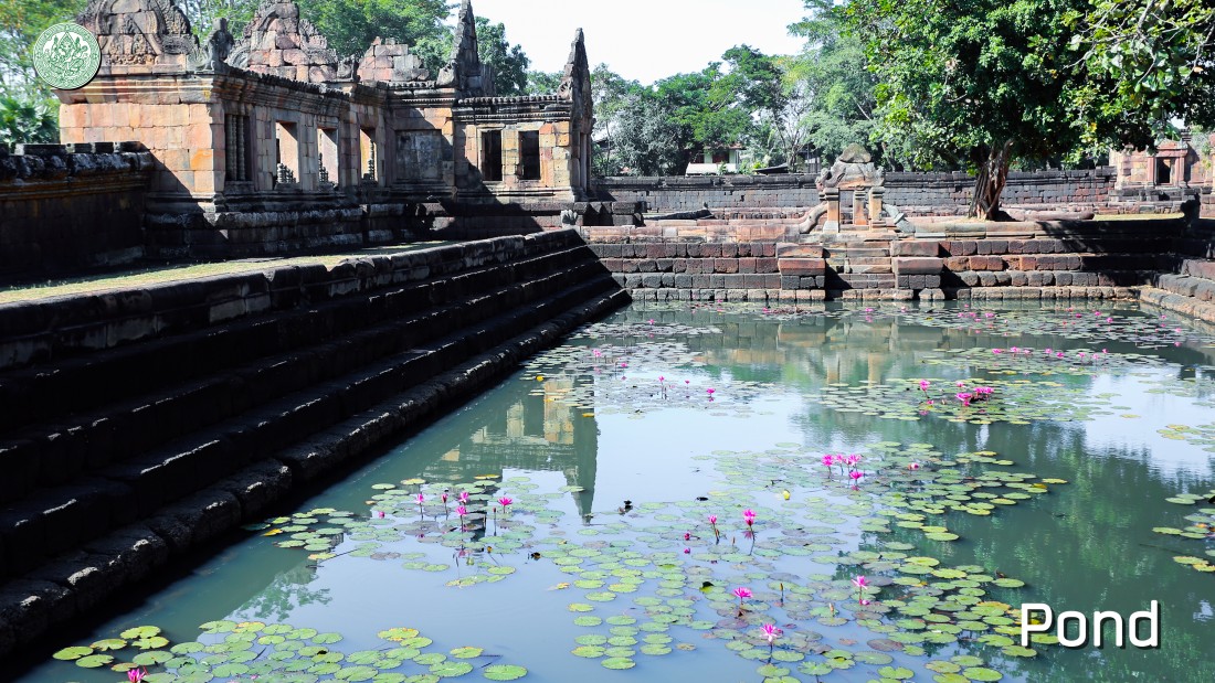
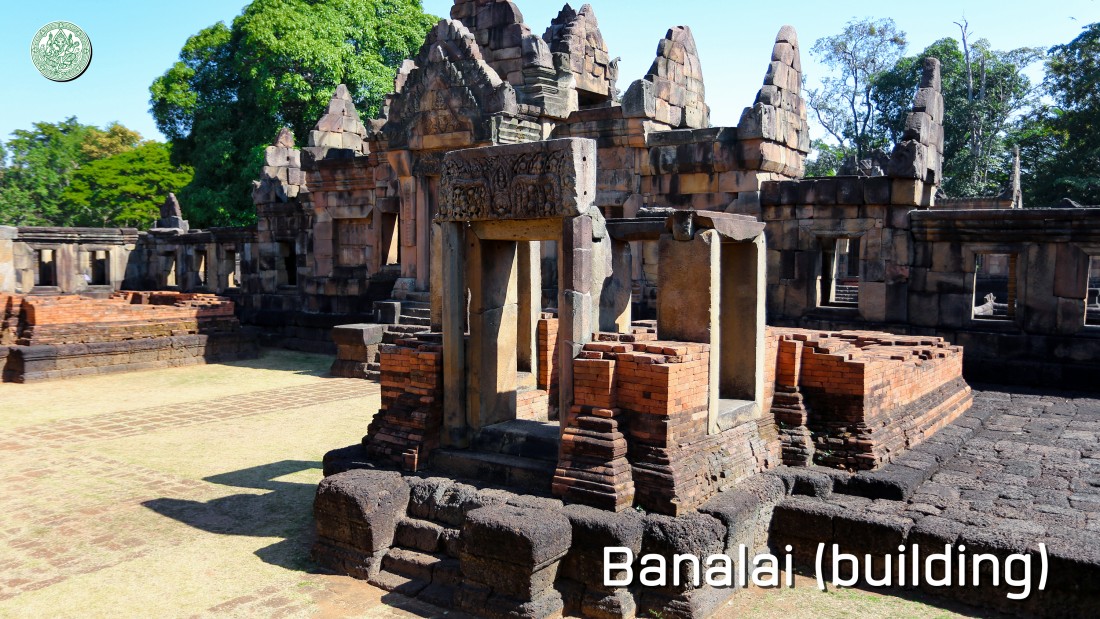
Conservation Background After a decline of Cambodia in the late 18th century Buddha, the culture, power, and religious place of Khmer were weak. It was abandoned for a long time same as Prasat Muang Tam. Until the Colonial Age, French explorer and academician has recorded the region exploration and the trail of religious places named “Prasat Muang Tam”. It appeared in the exploration report in 2444 and 2450 B.E. that informed the name “Muang Tam” may be called by comparing the location with Prasat Phanom Rung which located on the hill top. In A.D. 1910 from the book “Le Cambodge Tome II” of Aymonier, E, page. 131 has mentioned that Prasat Muang Tam is far from Prakhon Chai city to the southwest for 2 to 3 Yot (48 kilometers), 1 Yot (16 kilometers) from Phanom Rung Mountain to the south, and 1 Yot (16 kilometers) from Khao Phnom Dei (Khao Plai Bat) to the east. The name of “Muang Tam” in Thai language is unusual for the area that the folk used Khmer language like NOKOR TEAP or BANTEAI TEAP because this name is insulting called by the opposition when comparing with Phanom Rung. First, we will see a large Baray called La Harn or Ta le with 550*1,200 meters size and dug in the north, there is a border as high earthen dyke with 40 meters wide. The stream will dry in dry season, flow from Phnom Dei into Baray at the northwest corner and flow out at the southeast. Also has a water gate to control water level and drain for fishing easily. The distances of 100 meters to the south of Baray is a location of the historical site called city or rampart at present, there are trees like mango trees and coconut trees demonstrated it used to be a settlement for a long time around 2 generations ago. At present, the area becomes a swamp without people. An external defensive wall was constructed of laterite with 3 meters high surrounded as a rectangle area, 160 meters in the east and west, and 120 meters in the north and south. The main cores in four sides were dug as a large door. The inside areas between defensive wall and religious place is a location of a right angle pond with 10 meters wide and lined with laterite as a stairway. There is pathway along the axis that met in the middle of each side. At the northern pathway has a small pond with 1 meter depth lined with laterite and without water now. The raised building is located on the 1 meter-height retaining wall including a large entrance in the east side which flanked with cloister that taken all of space. There are 2 small entrances in the north and south and also a stairway and 5 Prasat It with various size in the west. In the middle part is rectangle layout called Phra Viharn. A lot of sculptures were found in the collapsed historical site. In A.D. 1907, Base on the Inventaire Descriptif Des Monuments Du Cambodge Tome II, annotated of Delajonguiere, E. Lunet., edit by Ernest Leroux, page 215 to 238 has mentioned that The name of Muang Tam may be from the location when comparing with Prasat Phanom Rung. It was surprising for the name in Thai language because the location is in the Khmer area which the most villages are Khmer name. However, it’s not needed to consider an importance of the two Prasat. Prasat Muang Tam is located in the south side of large Baray that some part was covered. It consists of a group of Prasat, internal cloister, internal pond, and external defensive wall. The five buildings were constructed of brick with a square layout that facing to the east. In the front row has three Prasat aligned from the north to south and two Prasat were cross situated in the back row. When considering every point of view, these Prasat are very ordinary design. The middle Prasat in the front row is larger than others, it probably has protruding balcony in the front door and situated on the laterite base that higher than another in the group. This all of can be seen because there are in ruins and also modified and taken a material from the historical site to use by local people. The component of the surrounding building is better condition than the Prasat, it is meticulous, but has not completed. Lintel is normal design that can be commonly seen as the design 3. The description as follows: 1. The northern building in the front row was engraved a figure of Shiva, Pawatee and Konanti female deities (Uma Mahesuan). 2. The southern building in the front row is an unidentified person figure. 3. The southern building in the back row is a figure of Phra Phrom with Phoenix (Phra Warun). 4. The northern building in the back row is an unidentified person figure. 2. The internal cloister surrounded the five Prasat which was constructed in some part. The wall until the part that linked with barrel vault of roof hasn’t finished construct. It is a system of the narrow cloister. The outside part is a solid wall that pierced as a lot of windows which facing to the internal courtyard. In the middle of the four sides cloister is a location of Gopura, there are 3 sides which has been completely constructed likes the eastern, northern and southern sides and the western side was just being constructed. The internal cloister is a large building that constructed of laterite sand same with the cloister, but has a surrounding wall like a rectangular specific room which opened to the long both side. There is a door that sticking out as the balcony with meticulous construction and normal decoration. Lintel is the design 3 with a few modify. It appeared the person figure which the most cannot identify. The eastern door inside of the eastern Gopura which is a figure of monkey plays with naga (Kritsana Prab Nak Kaliya) was obviously found. All of ancient site situated on a slope that higher than the surrounding areas. It was created as a retaining wall with cavetto (Luad Bua) to decorate as the base. The real and fake windows have a large size and also decorated with 7 balustrades. 3. The internal pond and internal cloister are surrounded with a right angle pond with 15 meters wide. In the middle of each side are spaced with 10 meters wide pathway into the internal Gopura. There are divided into four ponds, the upper edge constructed of laterite sand in a figure of Naga which the head sticking out or facing to a corner. 4. The external defensive wall is laterite rampart which decorated the wall part with 3.75 meters high. It surrounded the group of internal building as a square layout. In the middle of each side is the location of large Gopura that constructed of laterite sand. There are three entrances, the middle entrance passed a cross sign room. As the balcony sticking out in two sides while a next room that linking to a middle room becomes a minor entrance. At the door without balcony, a building was created as a large size with meticulous construction skill, but it was incomplete, such as a roof that begun the construction in some part and also a decoration and a forming that haven’t been completed as well. The eastern design in the east side of defensive wall is normal design. The front area has been indented as a base with cavetto (Luad Bua) and stairway. The protruding balcony outside of Gopura has been collapsed, but we can see a stone path and Nang Rieng pillar that long to the front.In 2472 B.E., Krom Phraya Damrong Rachanuphap, a high class officer of Thailand has begun an exploration of Prasat Muang Tam, he proceeded to visit Prasat Muang Tam in the occasion of proceeding to inspect antiques in Monton Racha Srima. In 2478 B.E., the Fine Arts Department has announced the registration of Prasat Muang Tam Ancient Site and specified the area of the ancient site in 2541 B.E. During 2530 and 2539 B.E., the Fine Arts Department has recreated and reconstructed Prasat Muang Tam by the method called Anastylosis and also renovated a landscape and constructed a facility until it was completed. In 2540 B.E., the Fine Arts Department has an invitation to Her Royal Highness Princess Maha Chakri Sirindhorn to proceed to Prasat Muang Tam for the Official Opening Ceremony in an occasion of The Fiftieth Anniversary (Golden Jubilee) Celebrations of His Majesty's King Bhumibol Adulyadej's Accession to the Throne on 10th November 2540. |
|
Conservation of Prasat Muang Tam The Fine Arts Department has announced the registration of Prasat Muang Tam Historical Site since 2478 B.E. in the Government Gazette, 23rd volume, 75th part, on 8th March 2478 and also created the landscape renovation project for returning the historical site to the nearest original state, conserving as a heritage to next generations, and opening as a field trip site. The project has begun from an evidence excavation in 2531 and 2532 B.E. including an archaeological excavation. In 2533 B.E., the Fine Arts Department has begun a reconstruction of the stone ancient sites by the method called Anastylosis. On the other hand, Prasat It (brick castle) can’t rebuild with the same method as the stone ancient sites. Therefore, they reconstructed and enhanced stability as far as possible. For instances, demolished a subsided laterite base, then casted a concrete at the subsided base and placed laterites back into their original positions. For the part that was not very damaged, they reconstructed by demolishing components and placing back into their original corner and angle. The decayed bricks that slide out, some part were demolished for cleaning and placing back into their original positions, using a new brick to enhance in some part and enhanced a stability of structure by concrete beam. The upper part of Prasat which collapsed as a hole was covered by concrete slab and placed over with brick again. A crack at base and Prasat were reconstructed by fixing. The lintel that falling down was installed into the original position by casting concrete beam to bear weight and latching a stone as an octagonal pillar to support lintel when without an original pole. The sandstone building has been reconstructed by the method called Anastylosis. The method by demolishing original components until base, write the code at every piece and note in diagram. It used the same method with the part that fall down which useful for placing components in the correct positions, then enhanced base stability by compacting soil and also enhanced reinforced concrete and placing components in their original positions and design. The reconstruction and landscape renovation of Prasat Muang Tam have been completed in 2539 B.E., Her Royal Highness Princess Maha Chakri Sirindhorn proceeded to Prasat Muang Tam to preside the official opening ceremony on 10th October 2540. |
|
Art and Architecture Prasat Muang Tam is the Hindu religious place with a highly valuable architecture. It was constructed of three materials, such as brick, laterite, and sandstone with a rectangle layout, 120 meters wide, 127 meters length and facing to the east. There are the architectural buildings as follows:
 |