")
")
|
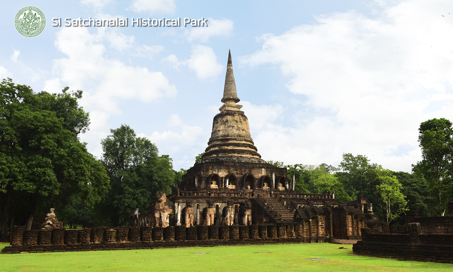
Si Satchanalai Historical Park is located in Moo 6, Tambon Si Satchanalai, Amphoe Si Satchanalai, Sukhothai Province at present. The downtown is situated on a plain by Yom River. There are three mountain ranges surrounding as a natural fortress, e.g. Khao Phra Si, Khao Phra Bat, and Khao Yai. An urban plan was placed as an intermittent rectangle layout with Yom River in the eastside. The inner rampart was constructed of laterite and the outer was retaining wall (moat and mound). Because the topography was proper to settle down, there are both river plain and mountain slope cause abundant in area and natural fortress for preventing an enemy. According to the archaeological excavation evidence at Wat Chom Chuan demonstrated this area has had human settlement since prehistoric age around 9th century Buddha. Then it has been continuously inhabited and also developed to the contemporary community as Dvaravati around the 11th and 16th century Buddha. In the 18th century Buddha, the evidence appeared at Wat Phra Sri Rattana Mahathat Chaliang as in that period, Si Satchanalai City is named Chaliang City as appeared in the inscription. The myth and the chronicle which affirmed the both ancient city as Sukhothai and Chaliang situated at Yom River Basin for a long time before moving the city center to the north side of Chaliang which far away about 1.5 kilometers, the city is called Si Satchanalai. Si Satchanalai and Sukhothai were important simultaneously as Mueang Luk Luang (vassal state). The importance of Si Satchanalai was continued until the war between King Borom Trai Lokka nat of Ayutthaya and King Tilokarat of Larn Na. Finally, Si Satchanalai is under the authority of Ayutthaya. In Ayutthaya period, the city was called Sawankalok while Larn Na called Chaing Chaun. When an occasion which Ayutthaya came under the Burmese siege for the second time, Si Satchanalai was completely abandoned for a long time until the reign of Phra Phutthayotfa Chulalok (King Rama I) of Rattanakosin that he pleased to move the villager family from Si Satchanalai to Tambon Wang Mai Khon which is Amphoe Sawankhalok at present.  |
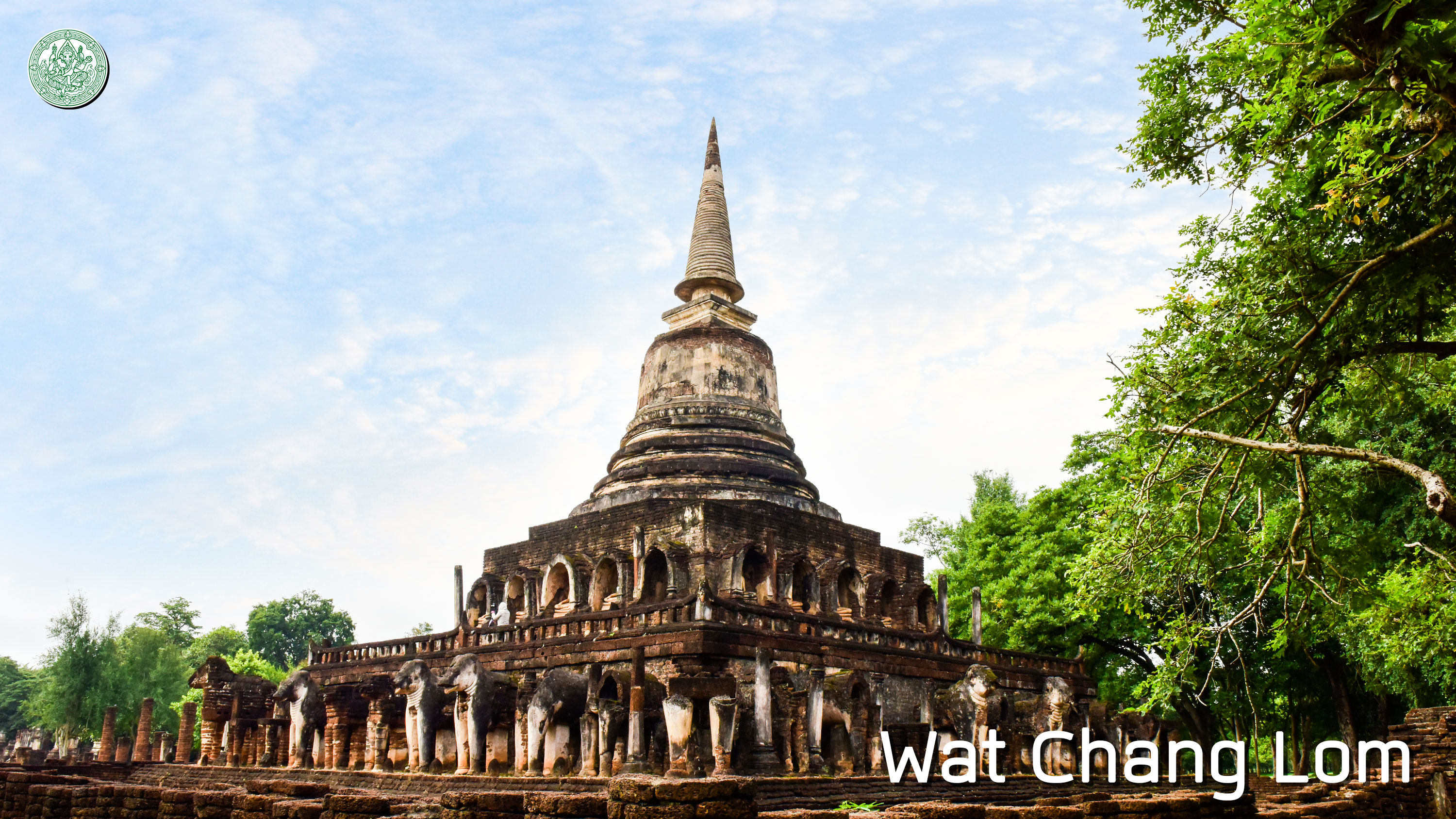
At present, there is a boundary announcement of Si Satchanalai Historical Park with the areas of 45.1472 square kilometers (28,217 Rai) and also found 281 historical sites. The important historical site in the area of rampart, such as Wat Chang Lom, Wat Chedi Ched Taew, and Wat Nang Phraya and also Wat Phra Sri Rattana Mahathat Chaliang, Wat Chom Chuan, Wat Chao Chun, Wat Phraya Dam, and Wat Sa Pathum at the outer rampart. Furthermore, also has the historical site on the mountain such as Wat Chedi Klao Yod, Wat Chedi Ain, Wat Khao Yai Lang, and Wat Khao Yai Bon, etc. |