")
")
Historical Background and Importance
|
The origin community before Kamphaeng Phet town Kamphaeng Phet Province is diversity of geography, it consists of low plain, hill, and mountain which proper for transportation. The agriculture and plenty of natural resources cause the area is a proper area for human living appearing social and cultural development since Prehistoric age until the present. In Prehistoric age of Kamphaeng Phet found the archaeological evidence that indicated the trail of New Stone Age community. This community is an agricultural community which has begun growing and farming. It can be interpreted from the archaeological site survey in the past, such as Khao Kalon archaeological site of Hat Cha Om village, Tambon Pa Phutsa, Amphoe Khanu Woralaksaburi which is a gravel mountain discovering the antiques both polished stone tool and socketed polished stone tool, stone tools look like blade and whetstone, pottery, terracotta weight, spindle whorl, glass and stone accessories as well as human bones. In addition, the archaeological evidences which demonstrated the Metal age and have been developed until the History period of Sukhothai were found. In the Metal age has the archaeological site which appeared the evidence about metal smelting in the areas of Kamphaeng Phet like Mor Suea Tob archaeological site of Klong Muang village, Amphoe Kosamphi Nakhon found a lot of furnace and dregs, assumed that it is dregs of copper and iron which contemporary to Klong Muang village, Amphoe Kosamphi Nakhon. Another archaeological site appeared the using of bronze tools, such as the archaeological site of Khor Plong village, Amphoe Bueng Samakkhi found bronze tools and accessories like bronze bracelet and bronze bell and also found bronze ware at Nong Kong village, Amphoe Mueang Kamphaeng Phet, etc. When passing through the Iron age which is the period that people has begun planning for their living, the intensely agricultural, and the society and culture are more complex, apart from discovering the iron antique, tool, and instrument at this archaeological site also found an influence of external culture which continuously developed to the History period as a community settlement that different from the past. People interested to set their house near a large river like Kosamphi city or Klong Muang ancient city which found the evidence of rectangle moat and mound and also found the trail of 2-layered square moat at Trai Trueng city. According to an archaeological excavation at Trai Trueng city, Dvaravati pottery and terracotta lamp as well as a lot of iron dregs which has been developed to Sukhothai Period were found. Base on a discovering of Sukhothai earthenware, Chinese porcelain of Yuan and Ming Dynasty, and the historical site which is an architectural identity of Sukhothai, such as lotus-bud shaped stupa at Wat Chedi Ched Yod and Wat Wang Phra Tat. It has appeared the evidence as a legend which mentioned to Kamphaeng Phet city before Sukhothai period. The Singhanawat Kuman legend specified that in 1480 B.E., Pom Kuman Prince battled with Khmer to seize Yoh Nok city to the south, he spend for 1 month to reach the Kamphaeng Phet ancient territory and also mentioned to the city again that in 1547 B.E. King Chai Siri of Wiang Chai Prakan evacuated Mon to the abandoned town of Kamphaeng Phet and set the dwelling near Ping riverside. Furthermore, the Chinnakarn Maleepakorn Chronicle has mentioned to Tambon Ban Kho which probably meant to Ban Khon village or Khon Tee city that the city is a hometown of Phra Rotchana Rat or Phra Luang of Sukhothai around 1800 B.E. According to the evidences found at all archaeological site, it can be assumed that Kamphaeng Phet had a community before Sukhothai period and also a similar culture with Dvaravati found at the central Thailand which can be defined age around the 12th – 18th century Buddha. Base on a discovering of archaeological site and archaeological evidence in the areas of Kamphaeng Phet Province since Prehistoric age that has developed to the History period. It is an important part which demonstrated the social and cultural development as well as the suitability of human settlement in Kamphaeng Phet area as well. |
|
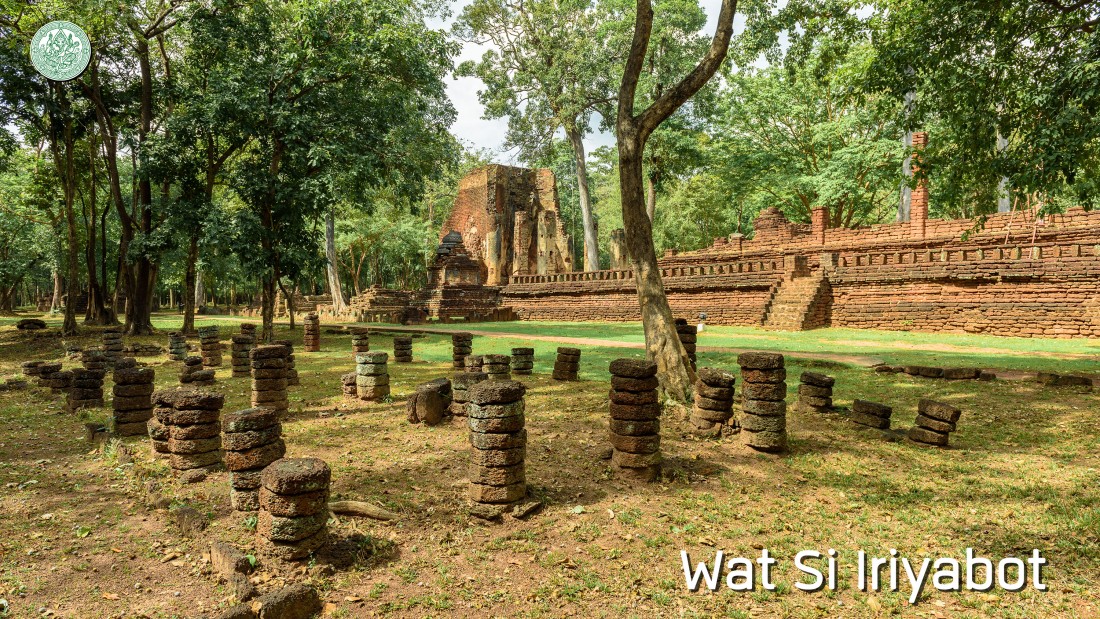
Kamphaeng Phet city around Sukhothai period The 1st stone inscription of Sukhothai (King Ramkhamhaeng inscription) and the 2nd stone inscription (the inscription of Wat Sri Chum) has mentioned to the role of important city of early Sukhothai includes Sukhothai and Si Satchanalai in the area of Yom River and also Saluang Song Kwae city in the area of Nan River. It hasn’t mention to Nakhon Chum city and Kamphaeng Phet in the area of Ping River. However, it also found the trail of ancient city that appeared moat and mound on the both side of Ping River which probably built since the early of Sukhothai period, such as Khon Tee city, Trai Trueng city, and Thep Nakhon city. The establishment of administrative center of the both side Ping River in Sukhothai period occurred in the reign of Phaya Lithai. The Nakhon Chum City on the west bank of Ping River near Suan Mark canal probably was the important city. The 3rd stone inscription (Nakhon Chum inscription) has mentioned that in 1900 B.E., Maha Thammaracha I (Lithai) proceeded to establish Phra Si Rattana Mahathat and grow Si Maha Pho tree from Lanka Taweep at the center of Nakhon Chum city. In addition, he enshrined the Buddha footprint at Nang Thong Mountain in Bang Parn city, Amphoe Phran Kratai. As the consideration from many evidences both archaeological site and inscription found that the role of Nakhon Chum city in a position of capital city at Ping river existed in a short time as appeared that after the reign of Maha Thammaracha I (Lithai), the administrative center also the religious and artistic prosperity were moved to the east bank of Ping River at Kamphaeng Phet city. After the death of Maha Thammaracha I (Lithai) (1913-1914 B.E.), the cities of Sukhothai were discordant. Some province was alliance with Ayutthaya and some province stand by Sukhothai as same. It was the same time with King Boromracha Thirat I (Khunluang Pha Ngua) of Ayutthaya send out troops for suppressing the cities of Sukhothai as mentioned in the Ayutthaya royal chronicle of Luang Prasert Aksorn Niti. During the time, Kamphaeng Phet performed as the center of Ping River area. Some academician believed that Kamphaeng Phet city was established for seizing a local mastery from Nakhon Chum city which the evidence obviously appeared that it was the province which has a strong relationship with Sukhothai, assumed that Kamphaeng Phet governor is relevant lineage between Sukhothai dynasty and Suphanabhumi dynasty. A story that appeared in the Chinnakarn Maleepakorn chronicle and Phra Buddha Sihing chronicle which is the legend of Larn Na have mentioned to Kamphaeng Phet governor named “Ti Phanya Amat” or “Phraya Yarnadit” invited Phra Buddha Sihing from Ayutthaya to enshrine at Kamphaeng Phet by the assistance of his mother, a princess consort of King Boromracha Thirat I (Khunluang Pha Ngua). The name of Kamphaeng Phet has appeared in the 38th stone inscription or Thai law which mentioned the name of king who enthroned Kamphaeng Phet city in 1940 B.E. The 46th stone inscription (the inscription of Wat Ta Tain Keung Nang) has mentioned to Phra Maha Thammaracha, a son of Maha Thammaracha I (Lithai) and Si Thammarat Mada Queen Mother invited a senior monk of Kamphaeng Phet city (Pacharaburi Sri Kamphaeng Phet) to Sukhothai for directing to build Wat Si Phichit Kirati Kalayaram in 1947 B.E. In the first part of this inscription has mentioned to the greatest power of Phra Maha Thammaracha. The invitation to the senior monk of Kamphaeng Phet demonstrated that Sukhothai accepted the role of Kamphaeng Phet as a center city of religion and art. In the late of Sukhothai Period, the evidence from Larn Ngun stone Inscription which found at the old stupa in front of Wat Phra Yuen of Aranyik (Wat Phra Si Ariyabot) in the northern external areas of Kamphaeng Phet has mentioned to an accession to the throne of Phraya Soi at Kamphaeng Phet town in 1963 B.E. which is in the reign of Maha Thammaracha IV (Borommapan) of Song Kwae city. The Phraya Soi who mentioned above will probably be Phraya Saen Soi Dao, king of Kamphaeng Phet in Ayutthaya royal chronicle of Phra Vachirayan Library. |
|
Kamphaeng Phet city around Ayutthaya period The inscription on the base of Bronze Shiva at Kamphaeng Phet National Museum has mentioned that Chao Phraya Si Thamma Sokarat enshrined (may be meant to sculpt) Shiva at Kamphaeng Phet in 2053 B.E., which is the reign of King Ramathibodi II of Ayutthaya. Furthermore, the inscription has mentioned to the temple reconstruction both inside and outside the city, roads, irrigation system, and water way to Bang Pan city of Amphoe Phran Kratai. These building reconstructions in Kamphaeng Phet dedicated to King of Ayutthaya both King Ramathibodi II and Somdet Phra Atitayawong before established to be a viceroy. When the territories of Sukhothai were under an authority of Ayutthaya in the middle of 20th century Buddha, Kamphaeng Phet was a northern province of Ayutthaya performed as an outpost that preventing enemy from the north in the reign of King Borom Trailokanat. The Ayutthaya assigned Kamphaeng Phet as Muang Phraya Mahanakhon (outer province) same as Phitsanulok, Si Satchanalai, and Sukhothai. The war between Ayutthaya and Chiang Mai in the reign of King Borom Trailokanat, Kamphaeng Phet is an important northern outpost along Ping River of Ayutthaya. The Ayutthaya chronicle of Luang Prasert Aksorn Niti has mentioned that in 2004 B.E., Phraya Chaliang leaded King Ti-Lokkarat force of Chiang Mai to seize Phitsanulok city but failed in seizing. Therefore, they moved the troop to Kamphaeng Phet and seized about 7 days, but failed again, thus Chiang Mai Force went back. |
|
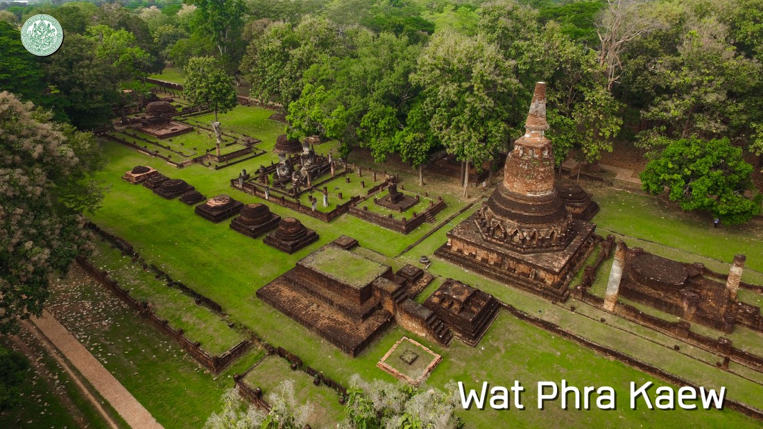
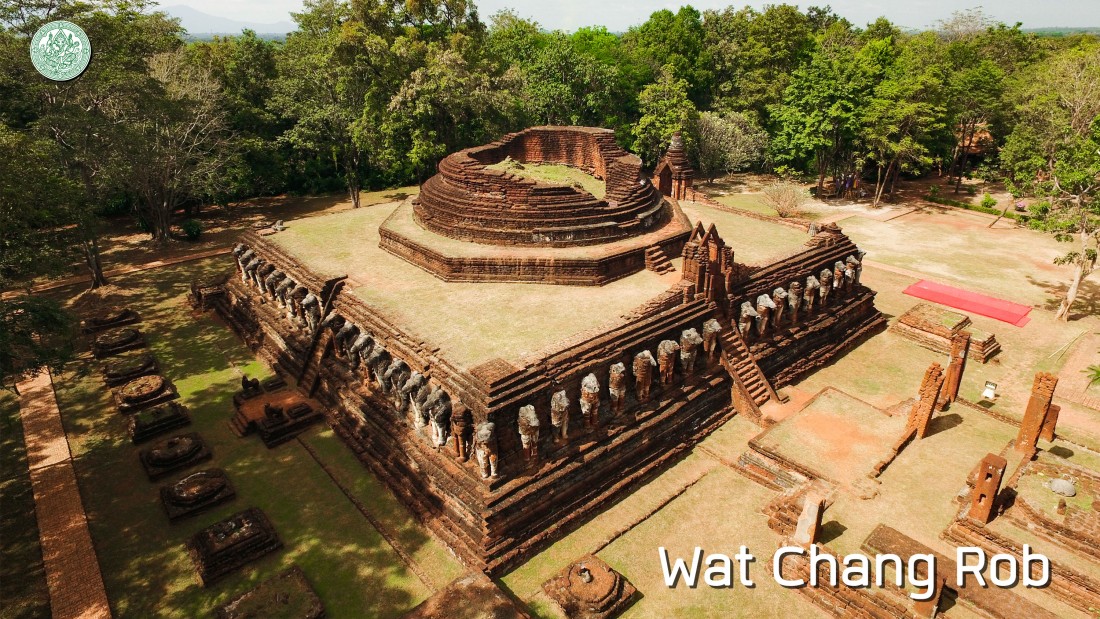
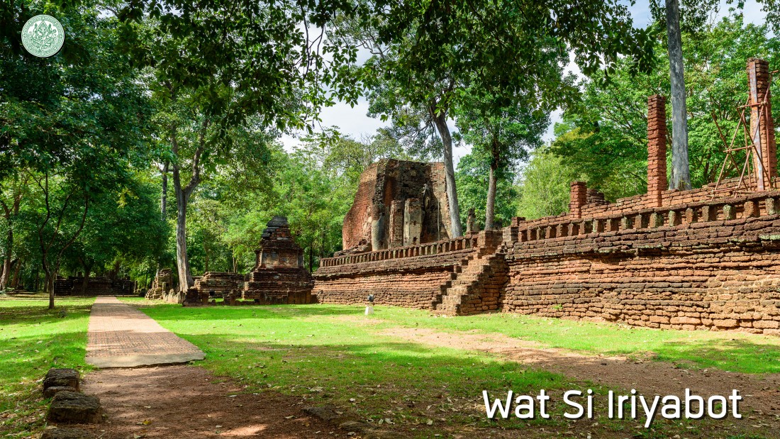
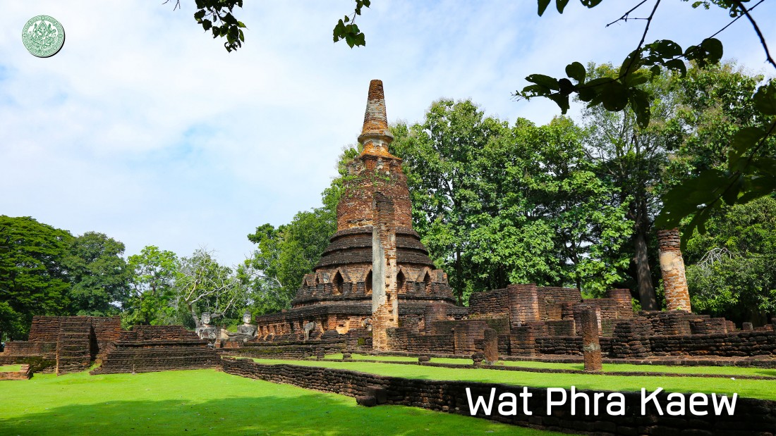
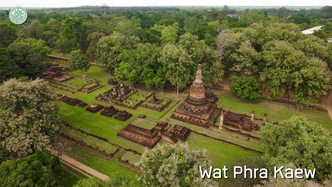
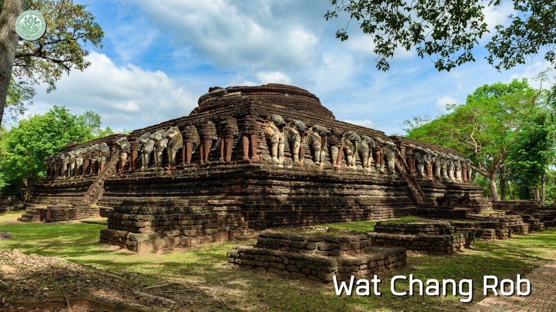
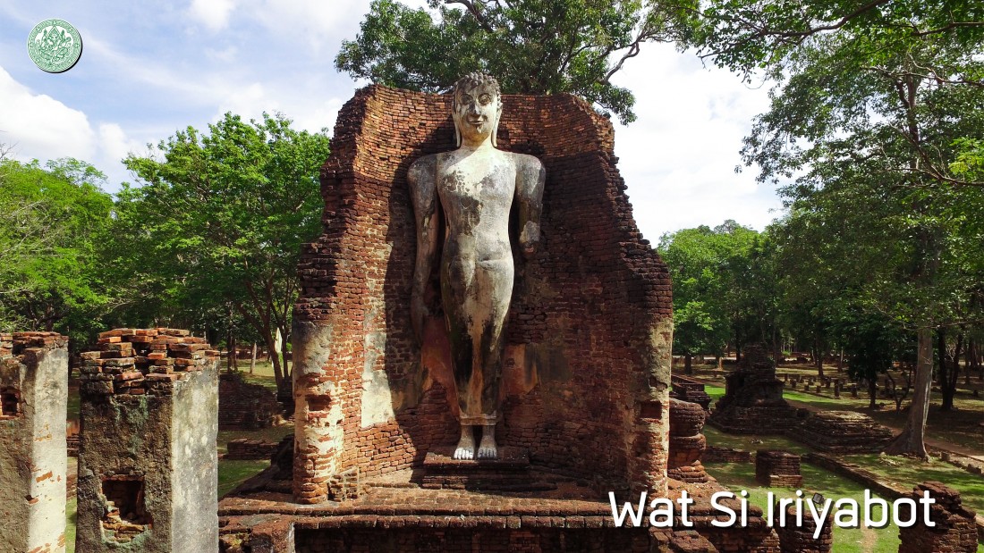
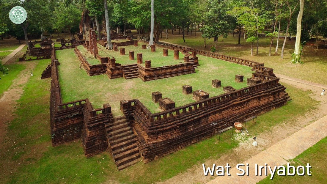
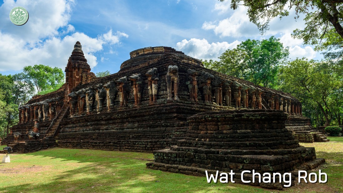
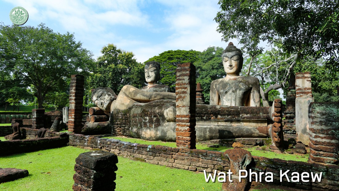
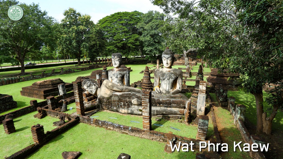
Historical background of archaeological work and preservation of Kamplaeng Phet Before 2478 B.E., the Fine Arts Department informed the Director Provincial Education Office and also the Director District Education Office in Thailand to survey the valuable archaeological sites and antiques in their provinces. After that, send the information back to the Fine Arts Department for announcing the registration to be the national archaeological site and antiques. In 2478 B.E., the Fine Arts Department has announced the registration of archaeological site by specifying a number of national archaeological sites in the Government Gazette, 52nd volume, 75th part, on 8th March, 2478. The 8 archaeological sites of Kamphaeng Phet were announced the registration be it Wat Avasa Noi, Wat Avasa Yai, Wat Tuek Praam, Wat Chang Rob, Wat Singha, Wat Phra Si Ariyabot of Amphoe Muang Kamplaeng Phet, Kamphaeng Phet Province as well as the stupa (Khao Nang Thong) and Nang Thong Cave of Amphoe Phran Kratai, Kamphaeng Phet Province. The registration has not announced the definite boundary of archaeological sites. In 2480 B.E., the Fine Arts Department has announced the registration of archaeological site by specifying a number of national archaeological sites in the Government Gazette, 54th volume, on 3rd January, 2480. The 1 archaeological site of Kamphaeng Phet was announced the registration likes the city rampart, Tambon Nai Muang, Amphoe Muang Kamphaeng Phet. In 2496 B.E., Field Marshal Plaek Phibunsongkhram, Prime Minister of Thailand at that time established the committee to reconstruct the historical sites of Sukhothai by Lt.Gen. Sawat Sorayut, Deputy Minister of Education is a chairman and representative of Ministries, Director General of Departments, and experts are committee members. Meanwhile, it has a survey of the nearby archaeological site likes Sri Satchanalai and Kamphaeng Phet city and also mow trees in the area of Wat Phra Kaew and Wat Phra That. During 2508 to 2512 B.E. there is a committee establishment to reconstruct the archaeological sites of Sukhothai and Kamplaeng Phet having Field Marshal Thanom Kittikachorn, Prime Minister of Thailand at that time is a chairman performed in the part of Kamphaeng Phet. The excavation and reconstruction were performed during 2508 to 2512 B.E. about 18 archaeological sites, such as San Phra Isaun, palace area or Sa Mon, the temple likes Wat Phra Kaew, Wat Phra That, Wat Phra Non, Wat Phra Si Ariyabot, Wat Chang Rob, Wat Avasa Yai, Wat Kalo Thai, Wat Sum Kor, Wat Chang, and Wat Avasa Noi and also the fortress likes , Pom Phet, Pom Chao In, Pom Chao Chan, Southwest fortification, Pom Pratu Wat Chang, and Pom Thung Setthi. After that, it has been continuously performed according to an annual budget. In 2511 B.E., the Fine Arts Department surveyed the archaeological sites around the ancient Kamphaeng Phet and Nakhon Chum city announcing the registration of archaeological sites in the Government Gazette, 85th volume, 41st part, on 7th May, 2511 with the areas of 3.8256 square kilometers (2,391 Rai). Zone 1: the archaeological site in the northern external areas of rampart or Aranyik zone with the areas of 2.5776 square kilometers (1,611 Rai). Zone 2: the archaeological site of Aranyik in the area of Wat Avasa Noi with the areas of 0.352 square kilometers (220 Rai). Zone 3: the archaeological site group inside of the rampart with the areas of 0.8048 square kilometers (503 Rai). Zone 4: the archaeological site in the areas of Nakhon Chum around Wat Chedi Klang Thung with the areas of 0.02 square kilometer (12 Rai, 2 Ngan). Zone 5: the archaeological site in the areas of Nakhon Chum around Wat Nong Lanka with the areas of 0.0148 square kilometers (9 Rai, 1 Ngan). Zone 6: the archaeological site in the areas of Nakhon Chum around Wat Nong Pikun with the areas of 0.0112 square kilometers (7 Rai). Zone 7: the archaeological site in the areas of Nakhon Chum around Wat Sum Kor with the areas of 0.0072 square kilometers (4 Rai, 2 Ngan). Zone 8: the archaeological site in the eastern external areas of Kamphaeng Phet rampart around Wat Kalo Thai with the areas of 0.0136 square kilometers (8 Rai, 2 Ngan). Zone 9: the archaeological site in the eastern external areas of Kamphaeng Phet rampart around Wat Tabeak Rai with the areas of 0.0136 square kilometers (8 Rai, 2 Ngan). Zone 10: the archaeological site in the northern external areas of Kamphaeng Phet rampart around Wat Dong Wai and Wat Chang with the areas of 0.0224 square kilometers (14 Rai). During 2523 to 2524 B.E. the Fine Arts Department has begun an exploration of the archaeological sites around Kamphaeng Phet city to create the preservation and exploration plan for specifying the way to develop to be the historical park. In 2525 B.E., the Office of Archeology of the Fine Arts Department and the Ministry of Education created the master plan of Kamphaeng Phet Historical Park Project (2525 - 2529 B.E.). The government put the preservation and development plan of Kamphaeng Phet Historical Park into the 5th National Economic and Social Development Plan (2525 - 2529 B.E.) in the name of “The Kamphaeng Phet Historical Park Project” includes 2 areas as rampart area and Aranyik area. This project has proceeded to the 6th National Economic and Social Development Plan (2530 - 25334 B.E.) that emphasized the archaeological site reconstruction and also public utilities and public facilities construction in the area of archaeological site inside the rampart and Aranyik area. |
|
The Opening of Kamphaeng Phet Historical Park In 2534 B.E., Thailand government cooperated with Thai people to preserve and develop Kamphaeng Phet Historical Park during 2525 - 2534 B.E. for celebrating to Her Royal Highness Princess Maha Chakri Sirindhorn on the occasion of Thai Heritage Conservation Day on 2nd April, 2534 B.E. as well as preserving the national cultural heritage to be existed as abiding civilization of the country. Her Royal Highness Princess Maha Chakri Sirindhorn proceeded to Kamphaeng Phet Historical Park to preside the opening ceremony on 18th April, 2534 B.E. |
|
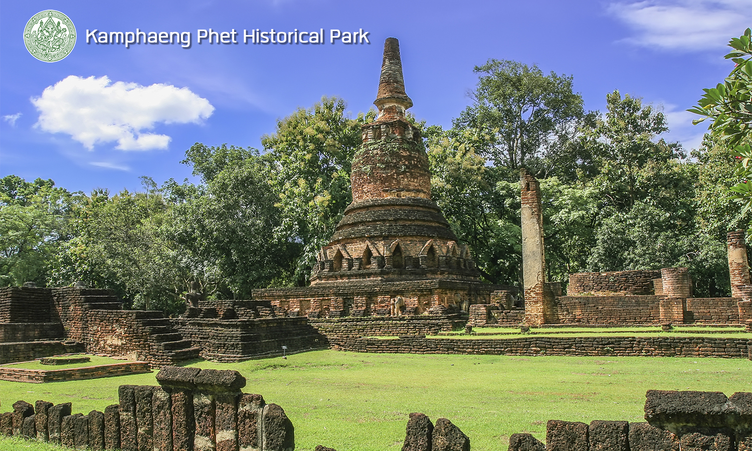
Kamphaeng Phet as a world heritage There are three cultural heritage sites of Thailand were registered as a world heritage of UNESCO like the Historic City of Ayutthaya, Historic Town of Sukhothai and Associated Historic Towns, and Ban Chiang archaeological site which three of them are important as the cultural heritage. The Historic Town of Sukhothai and Associated Historic Towns consist of Sukhothai Historical Park, Si Satchanalai Historical Park, and Kamphaeng Phet Historical Park which was prosperous at the same time. The Sukhothai kingdom is the center of prosperity in the 18th and 19th century Buddha and also the important art and cultural source as well as the historical source of the nation which reflected the greatest exquisite as can be seen from a unique architecture like lotus-bud shaped stupa or Phum-Khao-Bin stupa, an artistic Buddha statue which is the origin of Thai alphabet, Tri-Bhumi Phra Ruang, the important literature of Buddhism and also the water resource management by created the irrigation system for consumption in the city that still working well until the present being the evidence which reflected to a wisdom of people of the past as left until now. Criteria Sukhothai Historical Park, Si Satchanalai Historical Park, and Kamphaeng Phet Historical Park were announced the registration to be the world heritage in the name of Historic Town of Sukhothai and Associated Historic Towns in the 15th Ordinary Session of World Heritage Committee Convention in 2534 B.E. at Carthage city, Tunesia with the 2 qualifications corresponding to the world heritage criterion as follows: - The Historic Town of Sukhothai and Associated Historic Towns represented a masterpiece which created by the intelligent creation of human. - The Historic Town of Sukhothai and Associated Historic Towns is a representative of culture or civilization which appeared until the present or disappeared. |