| |
| The ancient town of Si Thep is located in Si Thep sub-district, Si Thep district, Phetchabun province on the high land of central Thailand which is the exchange network association of products, trade routes and cultures between the central and northeast region as they have been being important since the late pre-history till the ancient Khmer culture (8th – 18th Buddhist century) |
| The name “Si Thep Ancient Town” is originally called “Apai Salee Town” by local people. Looking back in 1904, His Royal Highness Prince Damrong Rajanubhab who was the chancellor of the Ministry of Interior at that time went on the inspection in the precinct of Phetchabun. He intended to seek out Si Thep town as it had been listed for the provinces in Ayutthaya and early Rattanakosin period at the former government house. He then found out a great ancient town on the east of Thamor Rat mountain near Wichian Buri town. As Wichian Buri town has been previously named “Tha Rong Town” and “Si Thep Town”, he has thought out that the name of this ancient town was originated by the old version of Wichian Buri “Si Thep Town”. Consequently, the Fine Arts Department primarily used that name as His Royal Highness Prince Damrong Rajanubhab had found out “Si Thep Town” till the new documentary evidences would have been proved for the real name of this ancient town. The ancient town of Sri Thep or Pai Salee has been protected as a national historic site listed in the Government Gazette, volume 52, page 3693, dated on March 8th, 1935 by the Fine Arts Department. After that, the study of this ancient town has been subsequently continued by the Fine Arts Department. Furthermore, academic research for archaeology and historical art in this town in this town has been done by Thai and foreign academicians. For example, Prof. M.C. Subhadradis Diskul, Dr. Quaritch Wales and Prof. Jean Boisselier. Since 1984, Si Thep ancient town has been conserved and developed for the important national culture learning center under the management of historical park style directed by Si Thep Historical Park, the 4th Reginonal Office of Fine Arts, Lopburi. |
| The physical landscape of Si Thep ancient town is surrounded by moats and ramparts and can be divided into 2 zones, inner and outer zones, on 4.7 square kilometers of its land. |
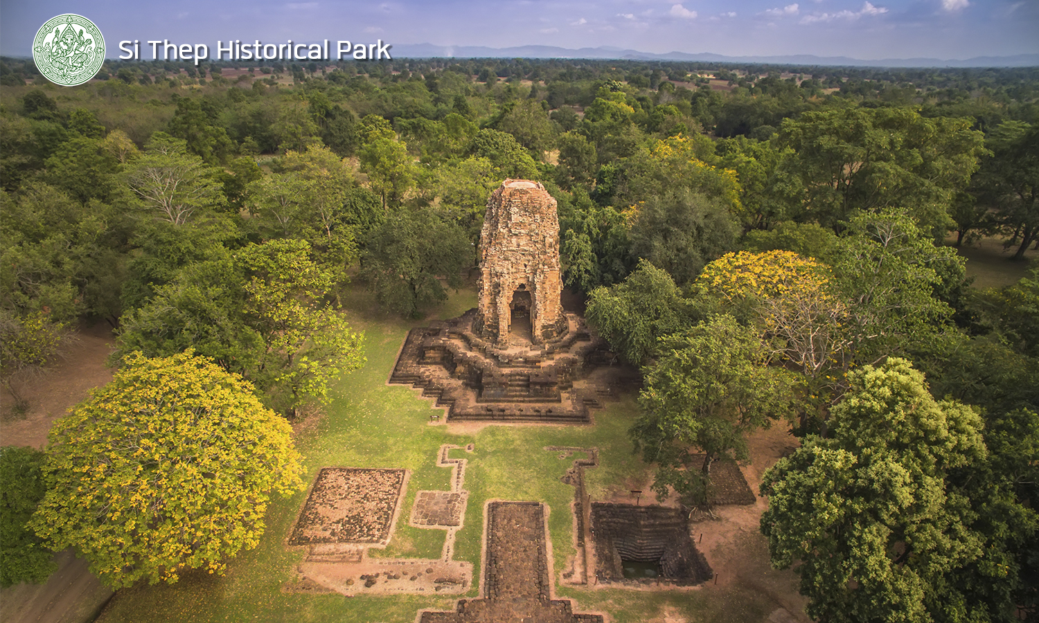
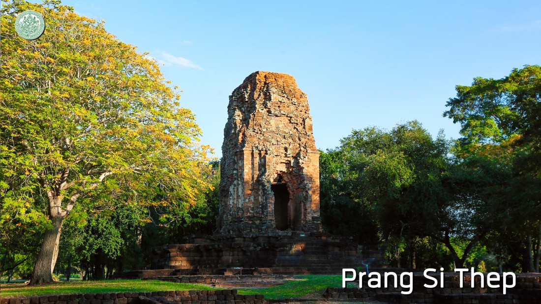
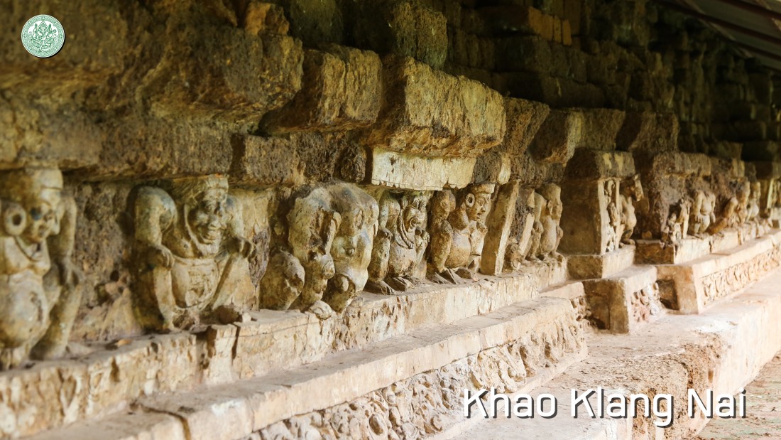
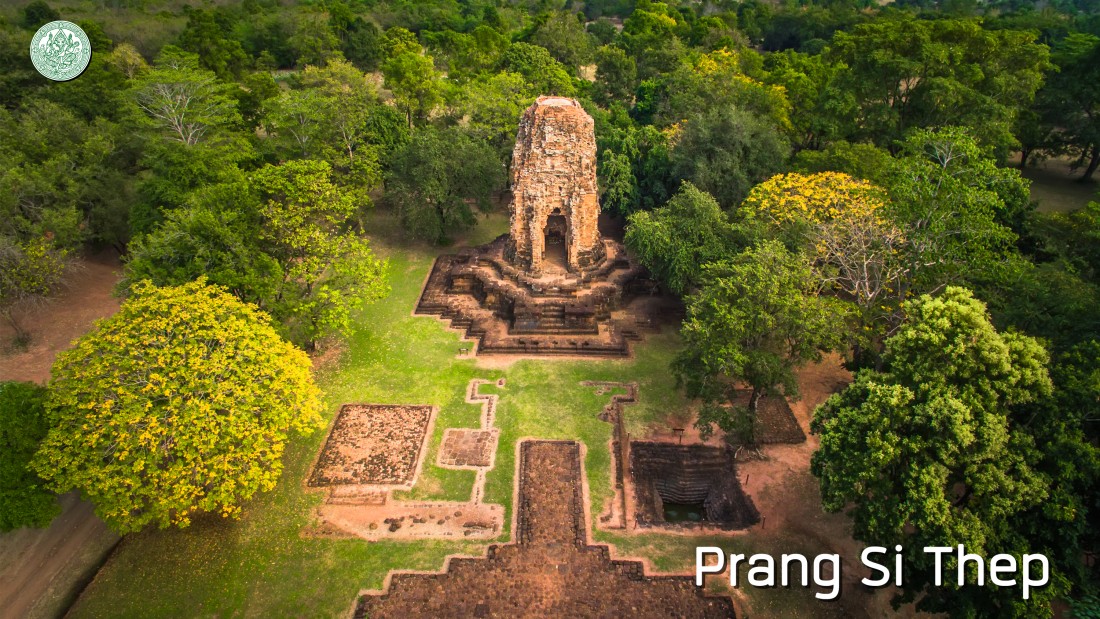
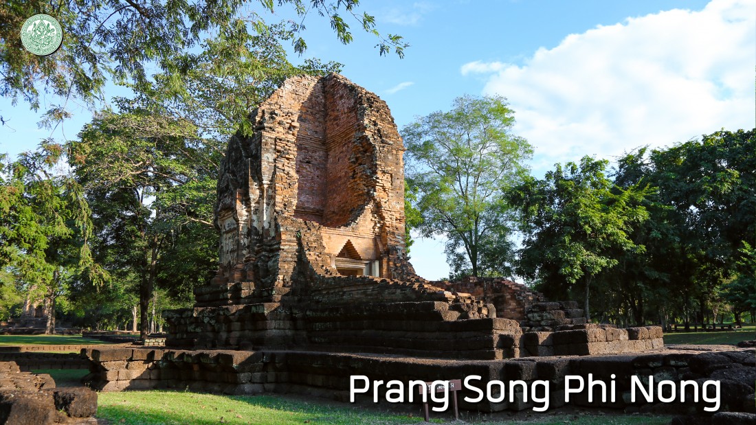
| The inner zone has owned 1.87 square kilometers in a quite circular city plan with wavy plain landscape. 48 historic sites are spread out and involving with Buddhism and Hindu. The art is influenced by Dvaravati (12th – 16th Buddhist century) and ancient Khmer cultures (16th – 18th Buddhist century). Major ruins are almost centered but slightly on the west of the town like Khao Klang Nai, Prang Si Thep and Prang Song Phi Nong. Besides, there are over 70 sites of big and small ancient ponds in this town. |
| The outer zone is on the east of the inner zone on 2.83 square kilometers of the land and the city plan is rather rectangular and rounded at the corners. 64 historic sites are found in this area comprising many ancient ponds. |
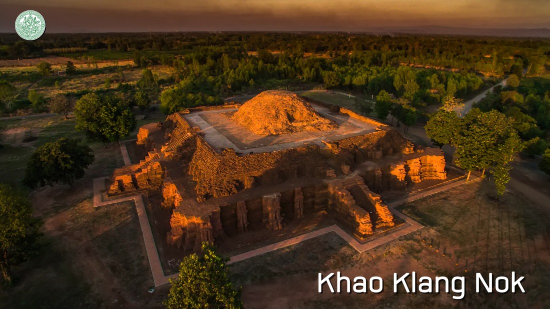
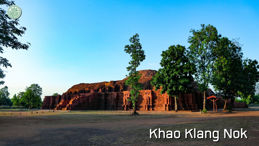
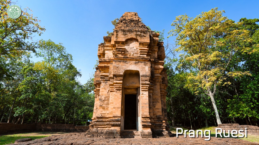
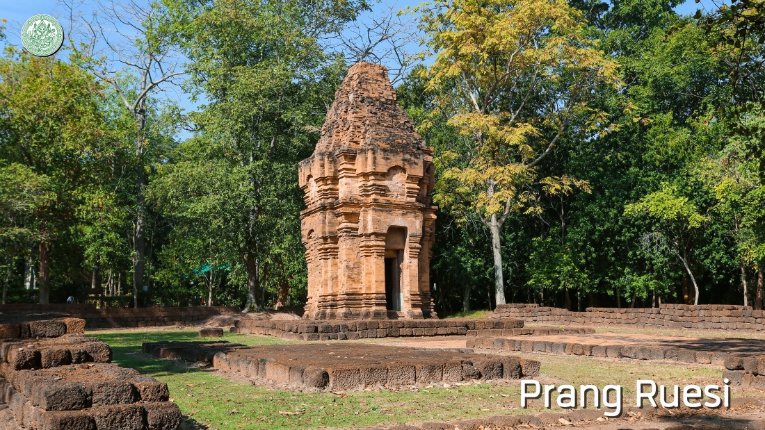
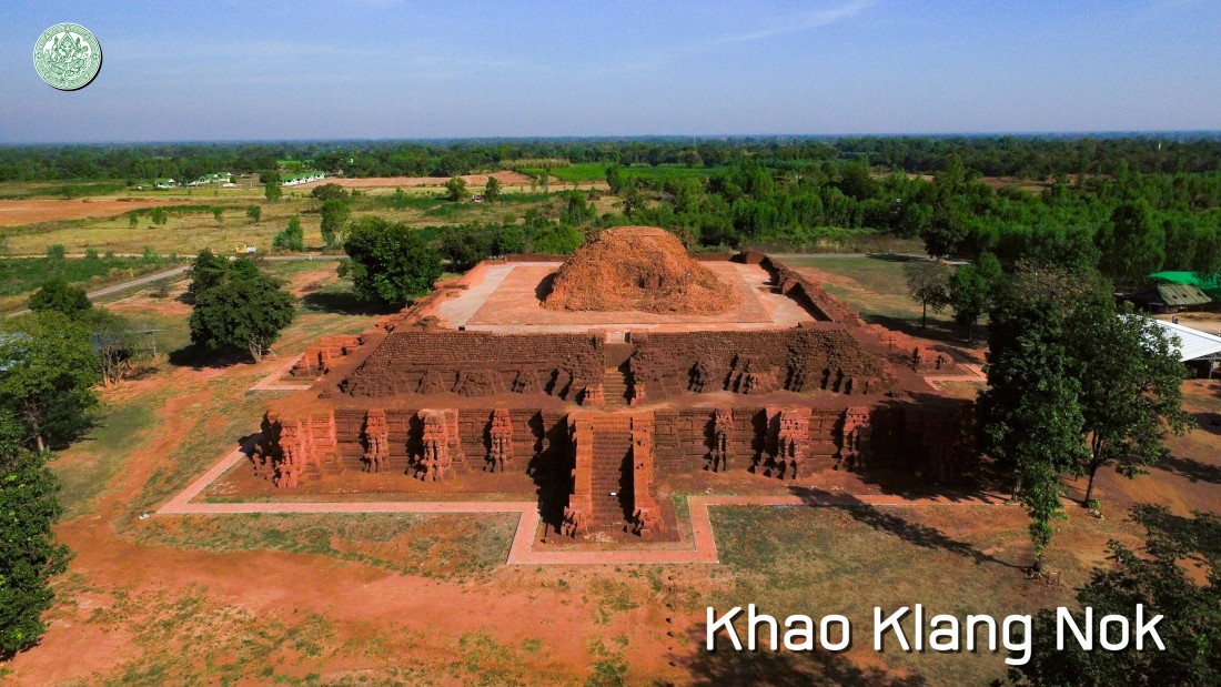
| There is also the exploration of other 50 historic sites out of the moat and rampart zone. Especially, the important ones are at the north of the town such as Khao Klang Nok, Prang Ruesi, a group of Khao Klang Sa Kaew and Sa Kaew, a big ancient pond. For another side on the west, Khao Thamor Rat, a unique configuration of a massive limestone mountain, is located 15 kilometers away from the outer zone of the town. It has been a landmark for the main journeys since pre-history and a major source of tool and stone bracelet invention at the foothills. Later in Dvaravati age, a limestone cave on the western east of the mountain was adapted for a place of worship in Mahayana. It was identified as in the age of 14th Buddhist century. |
| Si Thep ancient town stands out for an important town in the past as the networking routes for trading and cultures since the historical time of Southeast Asia has begun. Those things point out the ability to choose the right location for cultural association, integration, distribution and product exchange between internal and regional affairs which have been grown up since the pre-history by Dvaravati and ancient Khmer cultures from a farming society around Pa-Sak river basin in the late pre-history with 2,500 – 1,500 years passed by. This is how wise humans were considering choosing the right location to be socialized that they could control the nature routes to pass through Phetchabun Mountains. This is like a gate that is connecting between the east land at the central region plain and the high land at the northeast and also possibly included some area at the east and west of Southeast Asia as well. This prehistoric community became a main center of the route in exchanging the important metallurgy resources of Thailand in the late pre-history and stepped up to be a firm strategic location of trading and cultures in the area of the internal central region linking to maritime trade station and route. Therefore, it played the important roles of adopting and forwarding the cultures to other ancient towns in the same early history period. This ancient town is still striking a stunning spotlight of the cultural resource as it is situated in an internal central Thailand and points out the way of the creative intellect to integrate Theravada, Mahayana and Hindu artworks together until the unique style of its own art comes out. For example, a bunch of the old idols has been discovered here roughly 12th-13th Buddhist century such as the idols of Narayana or Vishnu wearing a circular cylinder hat and Krishna of Kowatthana which are round relief style showing the clear looks of standing tri-bent-posed anatomies or slightly inclined hips like they were moving. Those things can show us the unique elegance and perfect match in advanced skills of craftsmen which is known as “Si Thep art style”. The sculpture works and architectures in Si Thep ancient town from both Dvaravati and ancient Khmer cultures (11th – 16th Buddhist century) have been passed on the religious beliefs and the art styles through the art creations in later times. |
| Si Thep ancient town has stayed shining for a civilizer around 700 hundred years and then it has been down around early 18th Buddhist century at the same time with the downfall of Khmer Kingdom and the beginning of a new political power center at the north of Chao Praya basin in Sukhothai and Phra Nakhon Sri Ayutthaya. Those may result in a factor that caused fading away on the major roles of Si Thep ancient town and then being deserted finally. |
| In terms of stunning highlight, the ancient town of Si Thep grew up from ancient community in the late pre-history in the area of Lopburi-Pasak basin. Around 1,700 – 1,500 years ago (8th – 10th Buddhist century) when it was influenced by the extrinsic cultures, particularly, Indian and ancient Khmer cultures, it then led to the culture changes of urban socialization in Dvaravati (11th – 16th Buddhist century) and ancient Khmer cultures (16th – 18th Buddhist century). The evolutions of Si Thep ancient town in each period point out exchanging values of human beings in the internal central region of Thailand. Namely, it was an inner community or ancient town that kept growing the cultures and the dwelling location was chosen to be controllable or linkable to culture exchanging networks or the trade routes in the ancient time between the central region basin and the high plain of the northeast. This may be included the east and west area in the region of Southeast Asia as well. That is to say, the strategically located place of the town is a main point of the networks for resource exchanging and community trading in nearby area and outside regions since pre-history. So this resulted in social and culture changes as it stands for a major trading and religious center of the town in the early time of historical period in Thailand and Southeast Asia. The Fine Arts Department has realized for that goodness, so that they submitted it as a cultural heritage site of Si Thep ancient town to record in the tentative list in kind of the world heritage in 2019. |
|
|


